
New
Sale
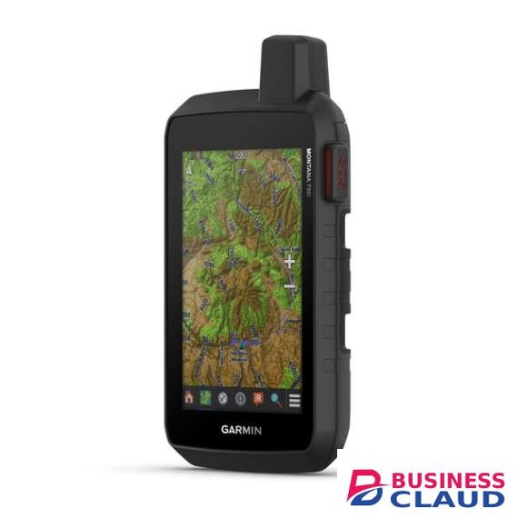

Garmin Montana 750i Rugged GPS Touchscreen Navigator
SKU.: BC12789421
✓ In stock
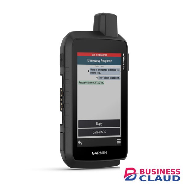
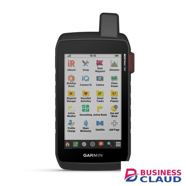
With inReach® Technology and 8 Megapixel Camera General Lens Material chemically strengthened glass Dimension 3.6" x 7.2" x 1.3" (9.19 x 18.30 x 3.27 cm) Weight 14.5 oz (410 g) with included lithium-ion battery pack Water rating IPX7 MIL-STD-810 yes (thermalprice shownock, water, vibe) Touchscreen Display Type WVGA transflective, dual orientation Display Size 2.55"W x 4.25"H (6.48 x 10.80 cm); 5" diag (12.70 cm) Display resolution 480 x 800 pixels Battery Type rechargeable lithium-ion (included) Battery life GPS Mode: up to 18 hours GPS Mode, 10 min Tracking: up to 18 hours Expedition Mode: up to 330 hours Expedition Mode, 30 min Tracking: up to 300 hours Memory/History 16 GB (user space varies based on included mapping) Interface high speed micro USB and NMEA 0183 compatible Maps & Memory Preloaded maps yes (TopoActive, by Region; City Navigator Maps, North America, Federal Public Lands Map, US only) Ability to add maps Basemap Automatic routing (turn by turn routing on roads) for outdoor activities Automatic routing (turn by turn routing on roads) for motorized vehicles Map segments price shown Satellite Imagery yes (direct to device) Includes detailed hydrographic features (coastlines, lake/river shorelines, wetlands and perennial and seasonal streams) Includes searchable points of interests (parks, campgrounds, scenic lookouts and picnic sites) Displays national, state and local parks, forests, and wilderness areas External memory storage yes (32 GB max microSD™ card) Waypoints/favorites/locations price shown Courses 250, 200 course points per course Tracks 250 Navigation Track Log price shown points, 250 saved gpx tracks, 300 saved fit activities Navigation Routes 250, 250 points per route; 50 points auto routing Rinex logging Sensors GPS Galileo Barometric altimeter Compass Yes (tilt-compensated 3-axis) High-sensitivity receiver GPS compass (while moving) Daily Smart Features Connect IQ™ (downloadable watch faces, data fields and apps) Smart notifications on handheld Weather forecasts Weather Compatible with Garmin Messenger app VIRB® Remote Pairs with Garmin Connect™ Mobile Safety and Tracking Features LiveTrack Tactical Features XERO™ Locations Outdoor Recreation Point-to-point navigation TracBack® Area calculation Fish forecast Sun and moon information Geocaching-friendly yes (Geocache Live) Custom maps compatible yes (500 custom map tiles) Picture viewer Camera yes (8 megapixel with autofocus; automatic geo-tagging) LED beacon flashlight inReach® Features Interactive SOS Weather Send and receive text messages to SMS and email Send and receive text messages to other inReach device Send and receive group messages Exchange locations with other inReach device MapShare compatible with tracking Virtual keyboard for custom messaging Send waypoints to MapShare during trip Send route selection to MapShare during trip inReach remote compatible Outdoor Applications Compatible with Garmin Explore™ app Garmin Explore website compatible Smart switching between Wi-Fi, Cellular and Satellite with Garmin Messenger app Dog tracking yes (when paired to compatible dog track system) Connections Connections Wireless Connectivity yes (Wi-Fi®, BLUETOOTH®, ANT+®)
You can explore our full range of Electronics.
from 1
USh 5,256,900.00
Incl. 0.16% VAT